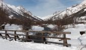

Le Casset

aja
Gebruiker

Lengte
8,1 km

Max. hoogte
1551 m

Positief hoogteverschil
119 m

Km-Effort
9,6 km

Min. hoogte
1466 m

Negatief hoogteverschil
119 m
Boucle
Ja
Datum van aanmaak :
2015-02-08 00:00:00.0
Laatste wijziging :
2015-02-08 00:00:00.0
2h30
Moeilijkheid : Gemakkelijk

Gratisgps-wandelapplicatie
Over ons
Tocht Sneeuwschoenen van 8,1 km beschikbaar op Provence-Alpes-Côte d'Azur, Hautes-Alpes, Le Monêtier-les-Bains. Deze tocht wordt voorgesteld door aja.
Beschrijving
Agréable balade de mise en jambe sans dénivelé, permettant de côtoyer la Guisane et le beau bois de mélèzes du Casset
Plaatsbepaling
Land:
France
Regio :
Provence-Alpes-Côte d'Azur
Departement/Provincie :
Hautes-Alpes
Gemeente :
Le Monêtier-les-Bains
Locatie:
Unknown
Vertrek:(Dec)
Vertrek:(UTM)
303888 ; 4983295 (32T) N.
Opmerkingen
Wandeltochten in de omgeving
Le Grand Lac


Stappen
Moeilijk
(2)
Le Monêtier-les-Bains,
Provence-Alpes-Côte d'Azur,
Hautes-Alpes,
France

5,2 km | 12,8 km-effort
5h 0min
Neen
La pointe de L'etandard


Ski randonnée
Medium
Le Monêtier-les-Bains,
Provence-Alpes-Côte d'Azur,
Hautes-Alpes,
France

9,4 km | 27 km-effort
4h 3min
Ja
05 col ponsonniere


Stappen
Medium
Le Monêtier-les-Bains,
Provence-Alpes-Côte d'Azur,
Hautes-Alpes,
France

14,4 km | 27 km-effort
6h 25min
Neen
pic est de Combeynot


Stappen
Zeer moeilijk
Le Monêtier-les-Bains,
Provence-Alpes-Côte d'Azur,
Hautes-Alpes,
France

13,3 km | 33 km-effort
6h 24min
Ja
l'aiguillette du Lauzet par le grand lac


Stappen
Moeilijk
Le Monêtier-les-Bains,
Provence-Alpes-Côte d'Azur,
Hautes-Alpes,
France

13,8 km | 29 km-effort
8h 39min
Ja
Chalet de l'Alpe - Grand lac - Croix 15/08/18


Stappen
Medium
Le Monêtier-les-Bains,
Provence-Alpes-Côte d'Azur,
Hautes-Alpes,
France

11,7 km | 22 km-effort
4h 23min
Ja
Via ferrata Aiguillette du Lauzet 30/06/18


Via ferrata
Medium
Le Monêtier-les-Bains,
Provence-Alpes-Côte d'Azur,
Hautes-Alpes,
France

9,5 km | 21 km-effort
2h 30min
Ja

Haut tour des Cerces


Stappen
Zeer moeilijk
(1)
Le Monêtier-les-Bains,
Provence-Alpes-Côte d'Azur,
Hautes-Alpes,
France

42 km | 77 km-effort
15h 27min
Ja
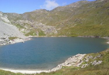
Le grand lac


Stappen
Medium
Le Monêtier-les-Bains,
Provence-Alpes-Côte d'Azur,
Hautes-Alpes,
France

10,7 km | 20 km-effort
6h 15min
Ja


 SityTrail


